
At the following link, you can download some suggestions for the basic bibliography about the theme of industrial remix:
///////////////////////////////////////////////////
At the following link, you can download all chapters of “TorinoAtlas”:
///////////////////////////////////////////////////
The working materials pertaining to the study area consist on several metric and cartographic data
and they can be used to explore, to analyse the site as well as to base the urban design phases.
Cartographic data is based on the Geoportal of the Torino Municipality and Spatial Data
Infrastructure database of CSI – Consorzio per il Sistema Informativo (Information System
Consortium) of the Piemonte Region, available with geo-services at:
http://geoportale.comune.torino.it/geocatalogocoto/?sezione=mappa
An updated Orthoimage of the area is provided. It has been commissioned and produced in 2018 by Torino Municipality for urban documentation purposes and updating of the Torino Technical Map, nominal scale 1:1000. The orthoimage was generated by a photogrammetric airborne flight by plane, ensuring a resolution on the ground (ground sampling distance) GSD = 0.5m. The Orthoimage for working purposes here is framed and scaled in a comprehensive A0 panel and subdivided in n°2 zoomed area, Nord-East and South-West, A0 too.
A vector drawing of the whole North-East part of the city is provided: it corresponds to a version of the Torino technical map in 1:1000 scale in *dwg format converted from the urban cartographic database in shapefile format (shapefile package of the area can be provided too).
3D metric products are provided here: they are related to the Lidar flight (GSD=0.5m) over the Torino Municipality in 2018, and derived from the 3D point cloud. The complete point cloud is available for those interested in using it as analysis and/or modeling data. A procedure of DSM segmentation has been applied to derived the ground and the objects. From the first one, a detailed 3D mesh of the terrain is provided in *.obj format.
Urban sections are orthoplanes in raster format, with graphic scale, extracted from the aerial
Lidar 3D point clouds and are referring to the direction specified in the key-plan file. They can
be helpful in the urban scale volumetric analysis of the site and its around.
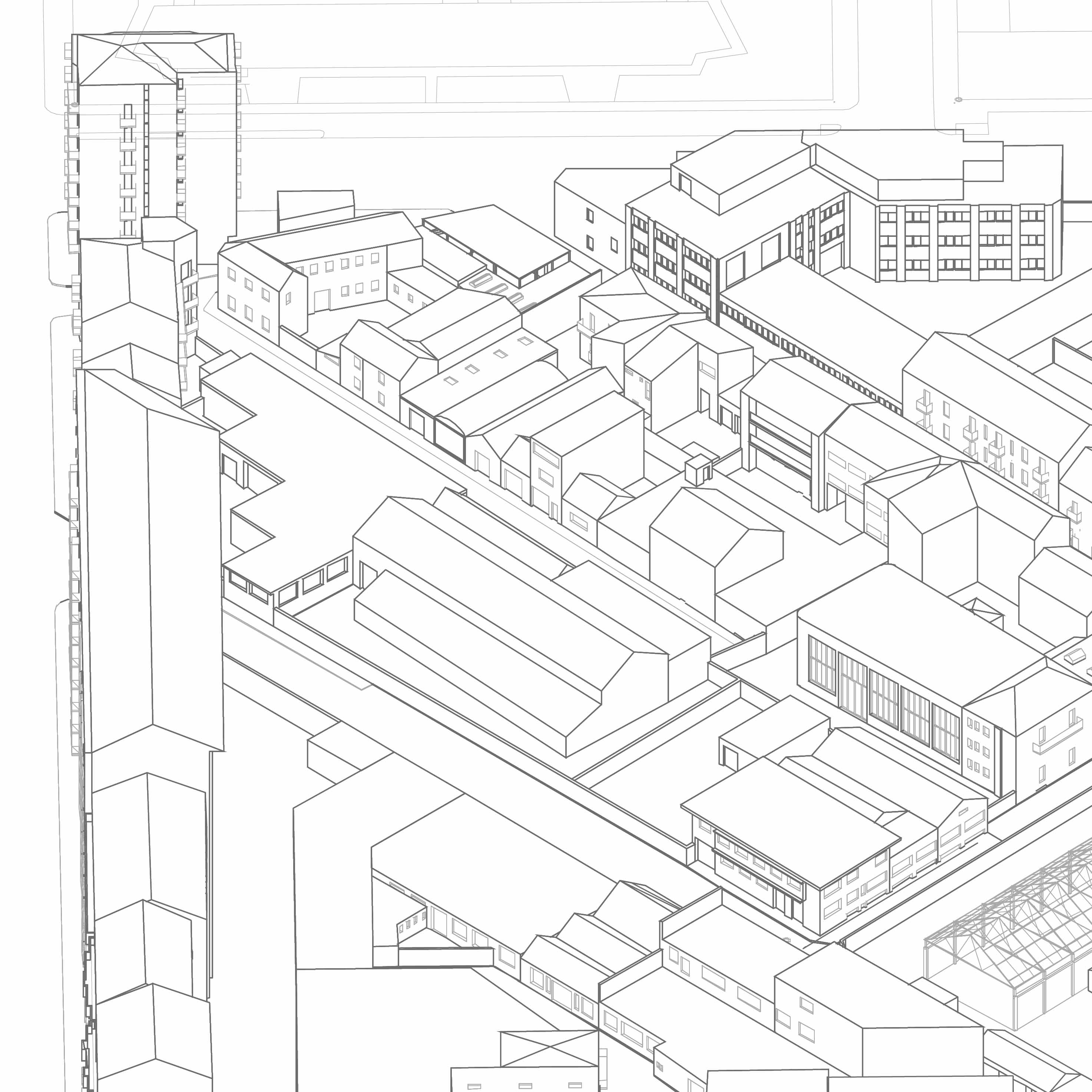
Furthermore, a detailed working 3D model of the area is provided which is
based on the union of the architectural-scale modelling of each building. In the folder is
available a *.skp file, an AutoCAD file and axonometric drawing of the design area.
